Size of this preview: 536 × 599 pixels. Other resolution: 787 × 880 pixels.
Original file (787 × 880 pixels, file size: 631 KB, MIME type: image/png)
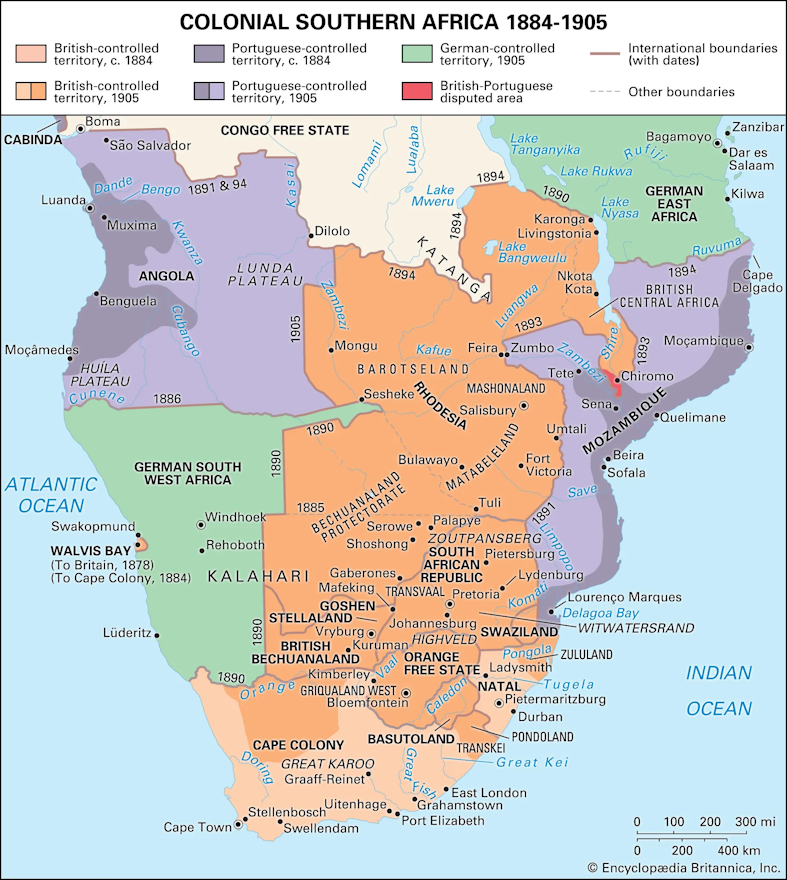
A map depicting colonial Southern Africa from 1884 to 1905.
File history
Click on a date/time to view the file as it appeared at that time.
| Date/Time | Thumbnail | Dimensions | User | Comment | |
|---|---|---|---|---|---|
| current | 10:13, 28 April 2024 | | 787 × 880 (631 KB) | Verda.Majo (talk | contribs) |
You cannot overwrite this file.
File usage
The following page uses this file:
.png&oldid=66045)