Size of this preview: 494 × 600 pixels. Other resolution: 732 × 889 pixels.
Original file (732 × 889 pixels, file size: 852 KB, MIME type: image/png)
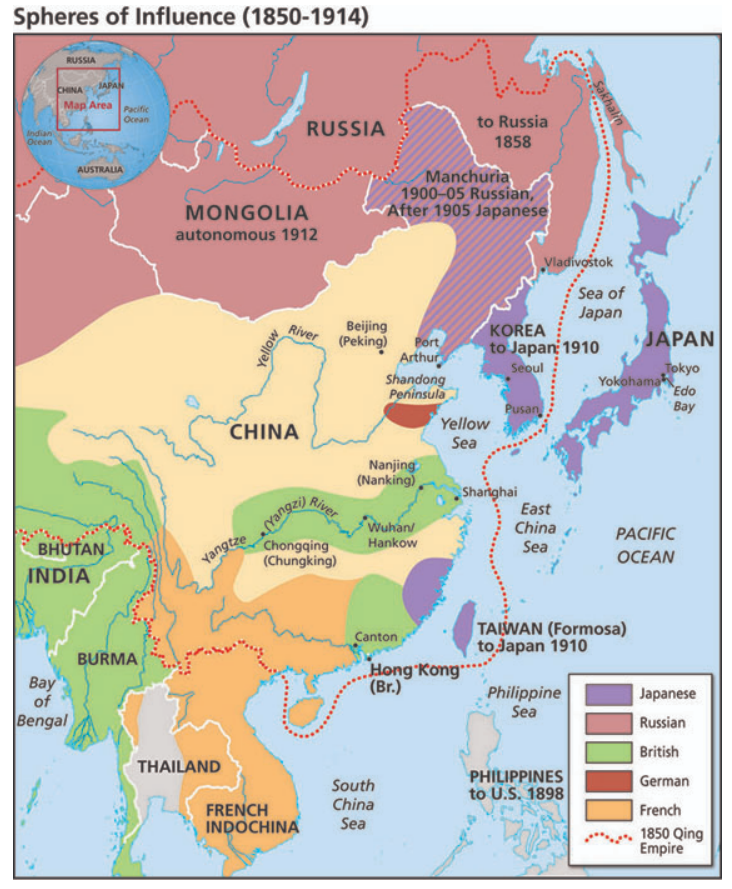
A map depicting colonial and imperial spheres of influence in Asia from 1850-1914.
File history
Click on a date/time to view the file as it appeared at that time.
| Date/Time | Thumbnail | Dimensions | User | Comment | |
|---|---|---|---|---|---|
| current | 05:51, 1 August 2022 | | 732 × 889 (852 KB) | Verda.Majo (talk | contribs) | |
| 05:48, 1 August 2022 |  | 567 × 700 (741 KB) | Verda.Majo (talk | contribs) |
You cannot overwrite this file.
File usage
The following 2 pages use this file: