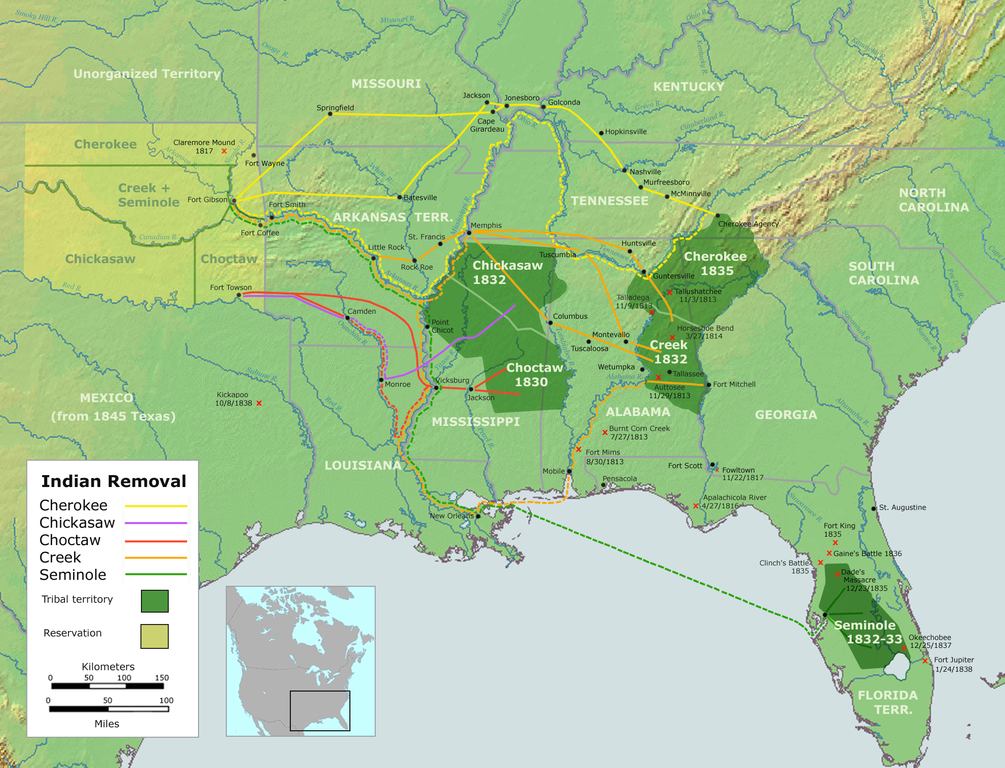
| Display title | File:A map of the process of Indian Removal in the US, 1830–1838. Oklahoma is depicted in light yellow-green..png |
| Default sort key | A map of the process of Indian Removal in the US, 1830–1838. Oklahoma is depicted in light yellow-green..png |
| Page length (in bytes) | 106 |
| Namespace ID | 6 |
| Namespace | File |
| Page ID | 5596 |
| Page content language | en - English |
| Page content model | wikitext |
| Indexing by robots | Allowed |
| Number of redirects to this page | 0 |
| Hash value | d7d1323dc7b7dc30b312c49afbed59234cd59979 |
| Wikibase item ID | None |
| Page image |  |
| Edit | Allow all users (infinite) |
| Move | Allow all users (infinite) |
| Upload | Allow all users (infinite) |
| Page creator | Verda.Majo (talk | contribs) |
| Date of page creation | 11:00, 1 September 2022 |
| Latest editor | Verda.Majo (talk | contribs) |
| Date of latest edit | 11:00, 1 September 2022 |
| Total number of edits | 1 |
| Total number of distinct authors | 1 |
| Recent number of edits (within past 90 days) | 0 |
| Recent number of distinct authors | 0 |
