Size of this preview: 800 × 480 pixels. Other resolution: 934 × 560 pixels.
Original file (934 × 560 pixels, file size: 69 KB, MIME type: image/png)
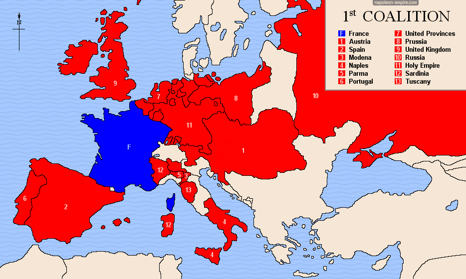
A map showing the 13 European feudal countries that formed an alliance against the fledgling French republic and invaded it in 1792.
File history
Click on a date/time to view the file as it appeared at that time.
| Date/Time | Thumbnail | Dimensions | User | Comment | |
|---|---|---|---|---|---|
| current | 16:31, 9 September 2022 | | 934 × 560 (69 KB) | CriticalResist (talk | contribs) |
You cannot overwrite this file.
File usage
The following page uses this file:
.png&oldid=16961)