More languages
More actions
No higher resolution available.
Map_detail_of_southern_Africa_with_independence_dates.png (468 × 474 pixels, file size: 23 KB, MIME type: image/png)
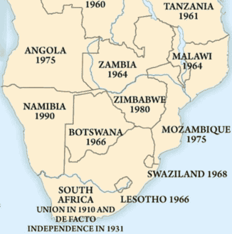
A map detail showing southern African countries with their formal dates of independence.
File history
Click on a date/time to view the file as it appeared at that time.
| Date/Time | Thumbnail | Dimensions | User | Comment | |
|---|---|---|---|---|---|
| current | 12:37, 8 March 2026 | | 468 × 474 (23 KB) | Verda.Majo (talk | contribs) |
You cannot overwrite this file.
File usage
The following 2 pages use this file: