
Size of this PNG preview of this SVG file: 740 × 600 pixels. Other resolution: 2,527 × 2,048 pixels.
Original file (SVG file, nominally 1,843 × 1,494 pixels, file size: 1.08 MB)
Summary
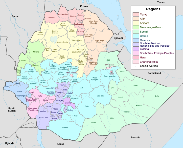
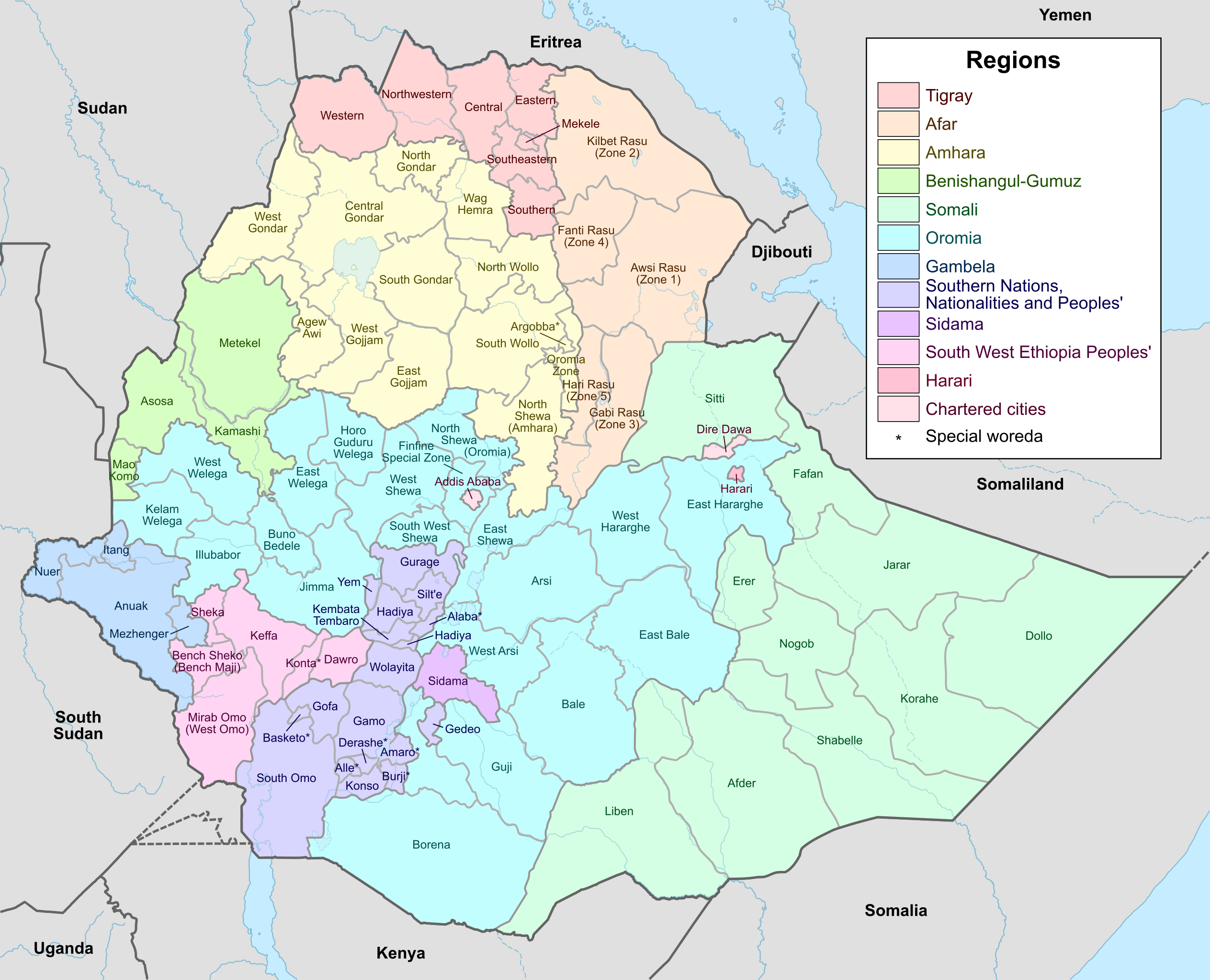
Map of the administrative zones of Ethiopia
File history
Click on a date/time to view the file as it appeared at that time.
| Date/Time | Thumbnail | Dimensions | User | Comment | |
|---|---|---|---|---|---|
| current | 21:32, 20 May 2023 | | 1,843 × 1,494 (1.08 MB) | CriticalResist (talk | contribs) | Map of the administrative zones of Ethiopia |
You cannot overwrite this file.
File usage
The following 2 pages use this file: