Size of this preview: 713 × 600 pixels. Other resolution: 850 × 715 pixels.
Original file (850 × 715 pixels, file size: 174 KB, MIME type: image/png)
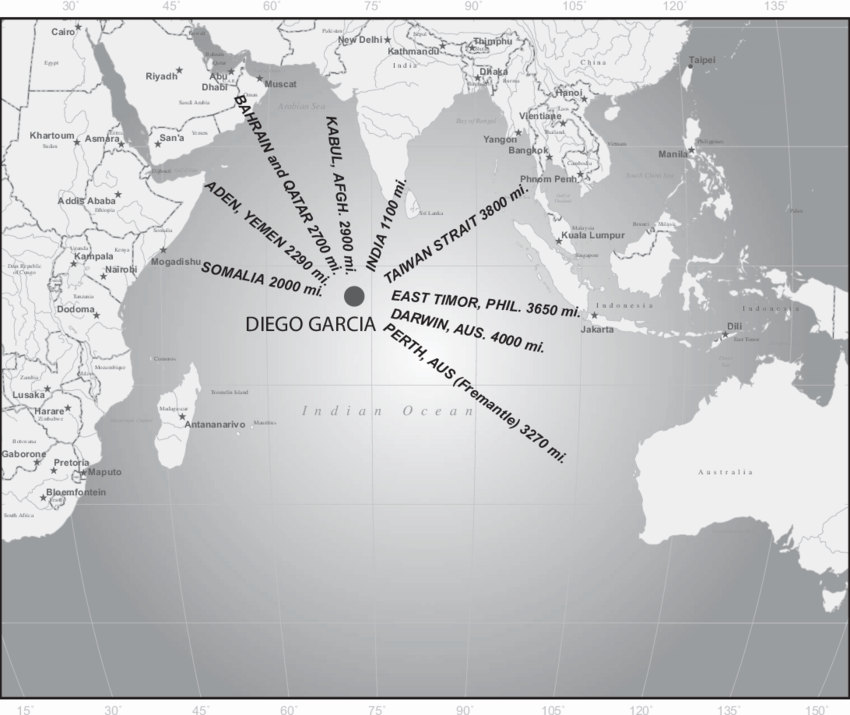
A map of Diego Garcia's location in the Indian Ocean, including labels of distances to various other locations.
Source: Andrew S. Erickson, Walter Ladwig, Justin D. Mikolay. "Diego Garcia and the United States' Emerging Indian Ocean Strategy" September 2010. Asian Security, vol. 6, no. 3, 2010, pp. 214–237. DOI:10.1080/14799855.2010.507408. https://www.researchgate.net/publication/254224904_Diego_Garcia_and_the_United_States'_Emerging_Indian_Ocean_Strategy
File history
Click on a date/time to view the file as it appeared at that time.
| Date/Time | Thumbnail | Dimensions | User | Comment | |
|---|---|---|---|---|---|
| current | 10:30, 16 April 2024 | | 850 × 715 (174 KB) | Verda.Majo (talk | contribs) |
You cannot overwrite this file.
File usage
The following page uses this file: