More languages
More actions
Size of this preview: 800 × 421 pixels. Other resolution: 1,109 × 584 pixels.
Original file (1,109 × 584 pixels, file size: 100 KB, MIME type: image/png)
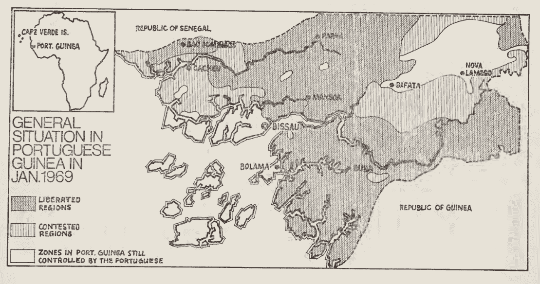
A map showing the situation in "Portuguese" Guinea in January 1969, showing liberated regions, contested regions, and zones still controlled by the Portuguese. Map is from the book Revolution in Guinea: An African People's Struggle, a compilation of Amílcar Cabral's speeches and writings.
Source: https://archive.org/details/unset0000unse_a2w1/page/6/mode/1up
File history
Click on a date/time to view the file as it appeared at that time.
| Date/Time | Thumbnail | Dimensions | User | Comment | |
|---|---|---|---|---|---|
| current | 09:39, 6 March 2026 | | 1,109 × 584 (100 KB) | Verda.Majo (talk | contribs) |
You cannot overwrite this file.
File usage
The following page uses this file: