No higher resolution available.
Ute_territory_map.png (768 × 506 pixels, file size: 293 KB, MIME type: image/png)
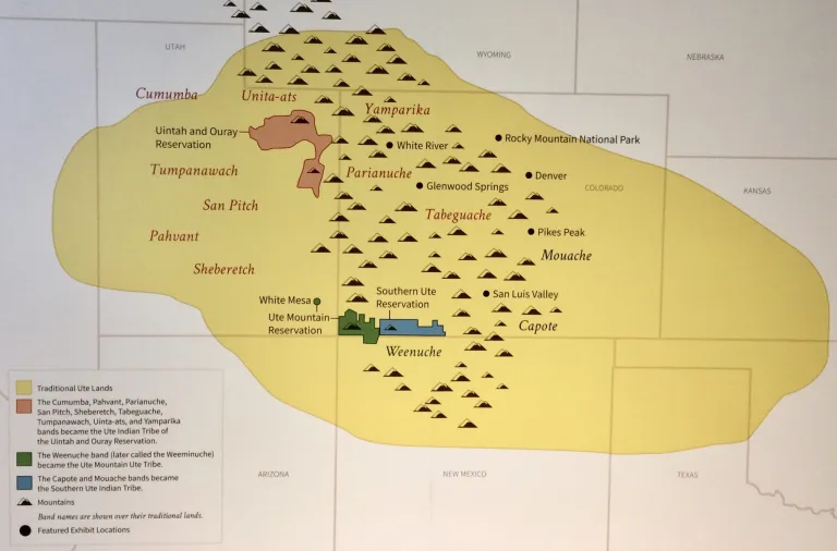
Map of the territory of the Ute nation
File history
Click on a date/time to view the file as it appeared at that time.
| Date/Time | Thumbnail | Dimensions | User | Comment | |
|---|---|---|---|---|---|
| current | 18:31, 21 January 2024 | | 768 × 506 (293 KB) | Ledlecreeper27 (talk | contribs) |
You cannot overwrite this file.
File usage
The following page uses this file: